Geospatial Technology
GIST Program Faculty
![]() K. Allison Lenkeit Meezan, GISP, has taught Geography and Geospatial Technology at Foothill College since 2000.
Allison teaches Introduction to Geospatial Technology (GIST 12) and the GIST Seimiar
(GIST 54A) and serves as the faculty advisory for the program. Prior to teaching at
the community college level, Allison worked as a GIS specialist with an urban planning
firm and as a Geospatial Technology curriculum educator with SRI International.
K. Allison Lenkeit Meezan, GISP, has taught Geography and Geospatial Technology at Foothill College since 2000.
Allison teaches Introduction to Geospatial Technology (GIST 12) and the GIST Seimiar
(GIST 54A) and serves as the faculty advisory for the program. Prior to teaching at
the community college level, Allison worked as a GIS specialist with an urban planning
firm and as a Geospatial Technology curriculum educator with SRI International.
In 2012 Allison was selected as one of the Top 20 National Geospatial Educators by the National Science Foundation. Allison participated in a national committee to build a Geospatial Model Curriculum that was vetted by industry and is now adopted by the GeoTech Center and the Department of Education.
Allison is active in the Bay Area Geospatial Technology community and her philosophy of teaching GIS focuses on building student’s foundation geospatial skills so that they can continue to grow and learn with advances in technology across the trajectory of their career.
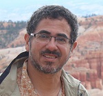
 Alexis Aguilar teaches Introduction to Mapping & Spatial Reasoning (GIST 11) and Geography at Foothill College. Alexis has a PhD in Geography with an emphasis
in biogeography (the geography of plants and animals). His PhD research was on forest
disturbance and recovery in a national park in his native Honduras. For his research,
he used GIS, GPS and Remote Sensing extensively and gained an appreciation of how
these tools help us see the big picture (maps) by collecting small details (data)
allowing us to answer complex questions.
As a geographer, he loves maps, and wants to infect his students with the map “bug.” He believes that before we can effectively use geospatial tools, we need to truly understand maps both as objects of utility and objects of beauty. Maps help us communicate, and like any work of art, good maps can be read and appreciated at different levels. Alexis works to help his students become map literate so that they become good map readers (interpreters) and writers (creators) of appealing maps that others will want to see. He also leads his students in the discovery of the exciting new world of online mapping, one that will allow them to tell unique and compelling stories through dynamic maps using widely available online tools and data.
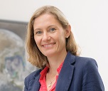
 Amber Wittner teaches Advanced Geospatial Technology & Spatial Analysis (GIST 53) and Geography.
Amber has been a part-time adjunct faculty member since 2014. She's passionate about
helping students find the intersection of their main interests within Geospatial Technology.
Outside of teaching for Foothill College, Amber works as GIS Coordinator for the US Geological Survey - Geology Minerals Energy and Geophysics Science Center(GMEGSC) where she is focused on implementing ArcGIS Enterprise, versioned database management and field data collection workflows via Cloud Technologies to support Geologist and Geophysicist mapping efforts. Previously, Amber served as a GIS Coordinator/Database manager within the US Forest Service and contractor at NASA Ames Research Center.
 Cristina Milesi teaches Remote Sensing and Digital Image Processing (GIST 58). Cristina worked on
the theory and applications of remote sensing for over 20 years, including 10 years
as a NASA research scientist. These days, when she is not in the classroom at Foothill,
Cristina applies her remote sensing expertise in precision agriculture and crop insurance.
Cristina's favorite part of teaching is getting the students excited about the numerous everyday applications of Remote Sensing and Geospatial Technology. Cristina loves Geospatial Technology because it helps us better understand the world, one map at a time.
Questions?
Please contact me!
K. Allison Lenkeit Meezan, GIS Department Chair
650.949.7166
Building 3000, Room 3020, Main Campus
